Taipei is located in a valley, flanked on its eastern and northern sides by beautiful mountain ranges. Because of this, there is an abundance of coastal hikes and cliffside cities that are within driving distance (and the public transportation range) of the city. One of the most famous is Teapot Mountain (or Wuer Chahu Shan), and after seeing a few pictures of the spectacular views that the trail offers, we decided we had to give it a go!
HOW TO GET THERE
- In Taipei, take Bus 1062 from the Zhongxiao Fuxing MRT station (located at the Blue and the Brown Line) heading toward Jiufen, all the way to the last stop, Jinguashi. Or, take Bus 695 from Zhongxiao Fuxing MRT station (or any of the other listed stations) heading toward Jiufen and get off on the last stop. We decided to take Bus 695, as the route takes only forty minutes, compared to the hour ride on Bus 1062 and also got off at Jinguashi. The buses are very comfortable, have free WiFi and AC, and have a ton of convenient stops throughout the downtown area.The whole trip will cost you $90NT (about $3USD) per person.
- You’ll arrive at a small bus circle near a Family Mart and a handful of old gold-mining buildings. Walk past all of these to the Gold Museum Tourist Information Center. To the left of this building there is a small path and a stone stairwell that will take you about a half mile down a windy hill. When you come across a fork in the road, take the path that leads across a bridge, over a small waterfall.
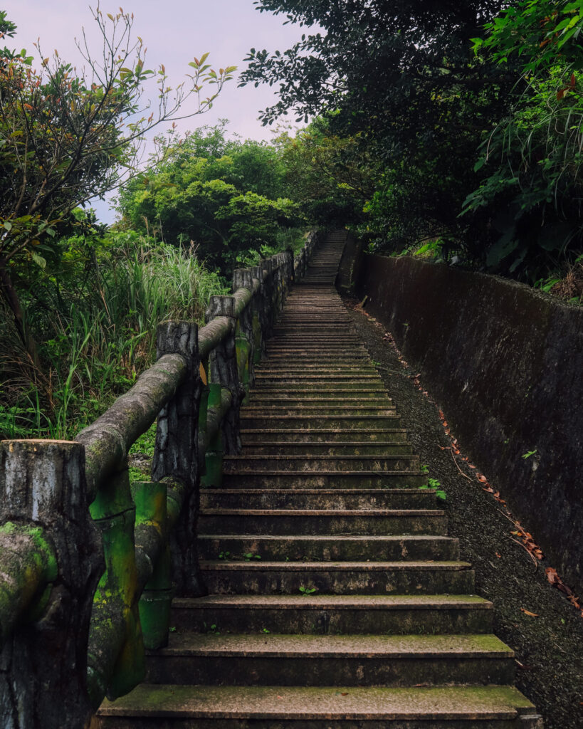
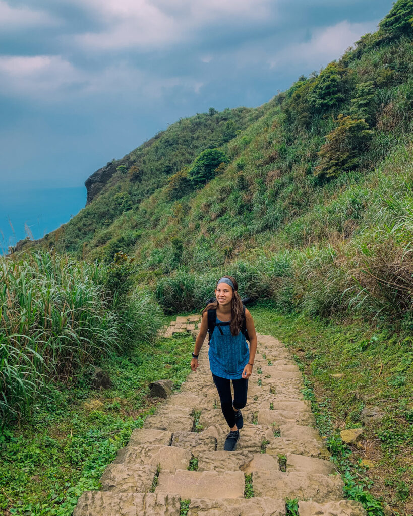
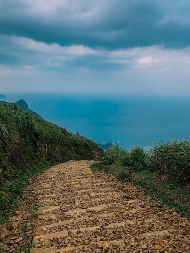 This path takes you up a ton of stairs (the fun begins!), and through a small, cliffside town. You’ll walk past a small restaurant, some shops, and eventually, a temple. Behind the temple, you’ll see another staircase (shocking). Keep climbing!
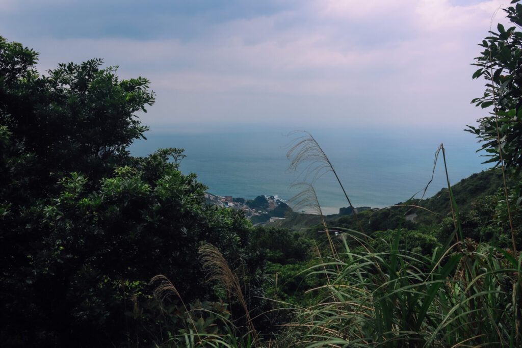
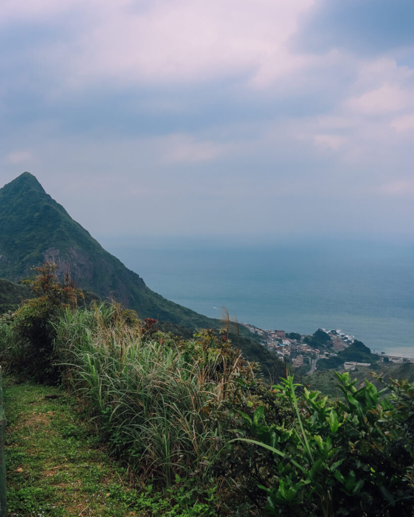
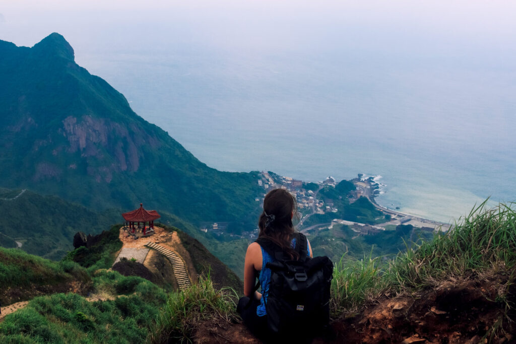
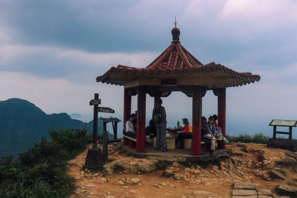
Along the path, you’ll come across a few lookout points that offer beautiful views of the coast and green mountains below, along with well-deserved rest stops to give your hamstrings a break before continuing the ascent. The most beautiful of these is a brightly colored pagoda about five hundred meters from the top.
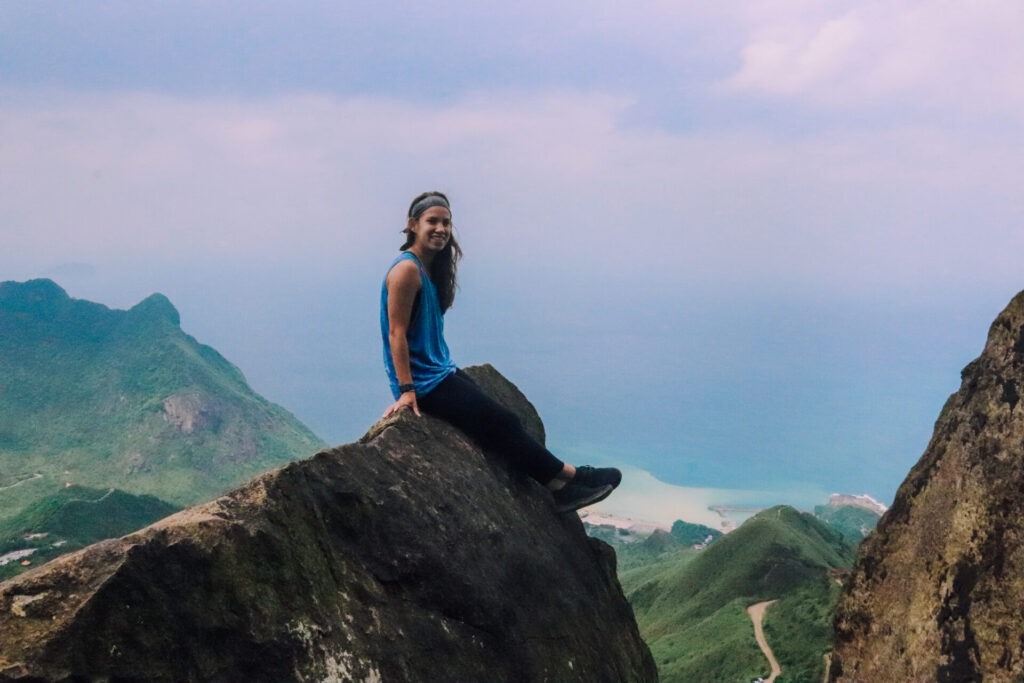
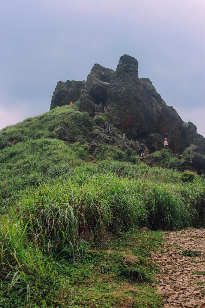
Finally, at the summit you’ll find Teapot Rock, where the real fun starts! The rock itself is hollow (like a teapot… clever), and there are dozens of ropes installed which make it possible for hikers and climbers of all levels to thoroughly explore the fascinating rock formation. Although we are not experienced climbers, we were able to easily make it up to the top of the rock pile, and got some pictures doing so. We were pretty proud of ourselves… until we saw a group of sixty year old women successfully follow our exact route.
Still felt pretty badass, though.
ADDITIONAL DETAILS
- A word of advice for beginner to intermediate hikers – be prepared! While the trail isn’t too long (about five miles round trip), the lack of shade and steep grade can be taxing! The hike has an overall elevation gain of over 1000 ft. Make sure to bring plenty of water and some snacks, and budget at least two hours hiking the trail, especially if you want to take pictures at the top (spoiler alert… you will).
- The bus to and from the trailhead takes forty minutes to an hour each way, and buses only run every hour. Make sure to check the schedule ahead of time, and MAKE SURE YOU’RE AT THE RIGHT BUS STOP. As is the case with Ximen, where we got on Bus 965, oftentimes one “station” will have multiple stops within a few block of each other, so make sure your bus is listed on the board at that particular bus stop. There’s also a great app called “MoveIt” which thoroughly tracks Taipei’s buses, and will let you know in real time where your bus is. It helped us out a ton on this trip, and it’s totally free, so we highly recommend.
- This hike is great to pair with a trip to Jiufen, a beautiful cliffside town. If you want to get to Jiufen from Jinguashi, or vice versa, there are buses that come every fifteen minutes or so (965, 1062 among others). When in doubt, just ask the driver if they’re going to Jiufen Old Street, and they’ll let you know.
- Bus 965 and 1062 will also take you back to Taipei. They run from 6:00AM to 9:00PM on the weekdays, and 7:00AM to 9:00PM on the weekends, so as long as you’re not partying too hard out there, you probably won’t miss the buses back.
- You can also take a taxi straight to the trailhead, which will save you two miles of walking and thirty minutes of driving, but will set you back $1000NTD ($30+) USD.